
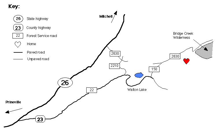
The Directions Are Here!!!
Howdy Folks
The 26th Annual Gathering of the Tribes is located in the Ochoco National Forest near Prineville, Oregon
From Prineville, Oregon: Take Highway 26 east to road 23.
Road 23 becomes Road 22. Continue past Walton Lake to the end of pavement
and turn LEFT on Road 150. Veer RIGHT onto Road 2630.
Welcome Home !!!
From the east on highway 26: Go west of Mitchell, Oregon to Road 2630
Road 2630 becomes Road 2210. Turn LEFT on Road 22.Continue past Walton Lake to the end of pavement
and turn LEFT on Road 150. Veer RIGHT onto Road 2630.
Welcome Home !!!
WE LOVE YOU!!!
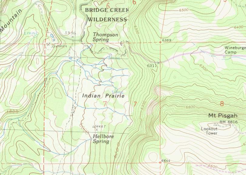
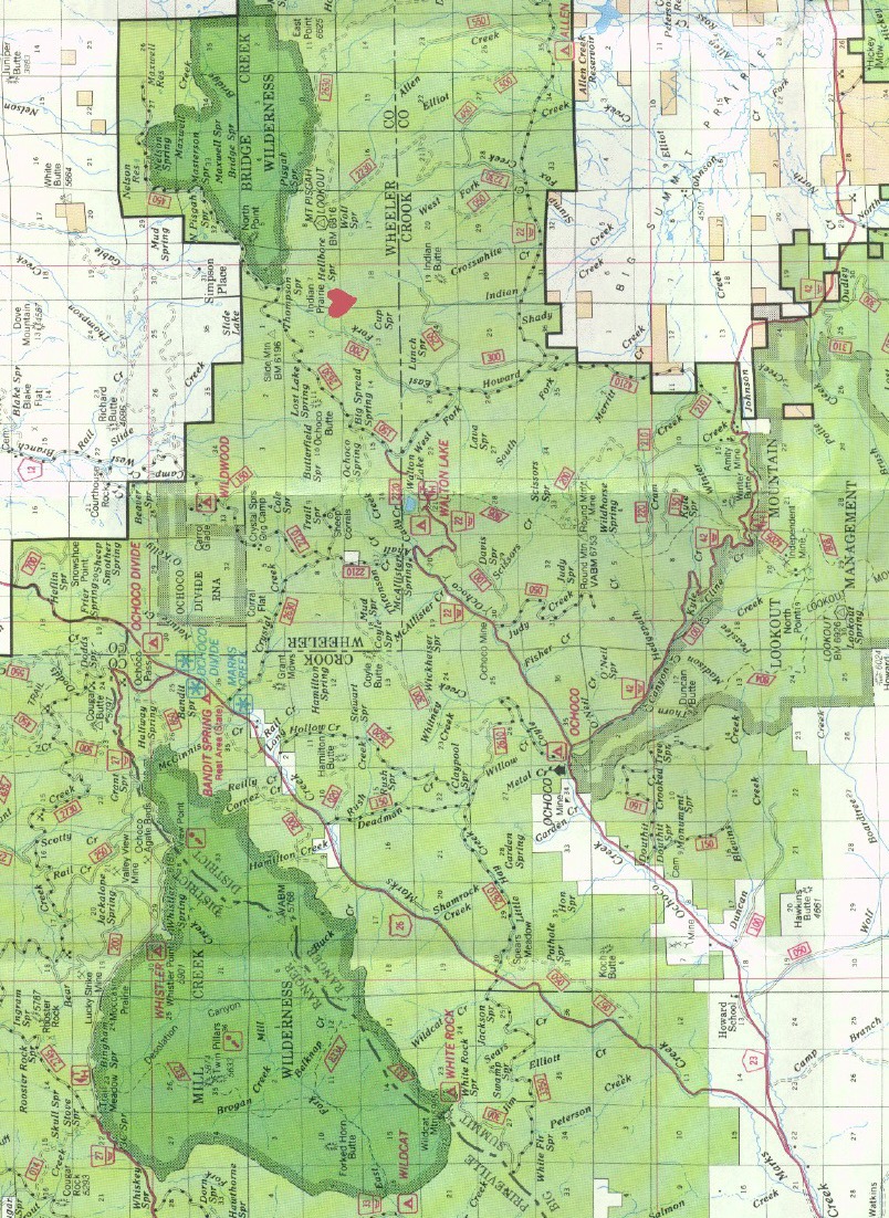
A close-up of the site showing elevations, streams, roads, and trails. Note that this map was taken from two seperate source maps that have been combined into a single map. The source maps used different intervals for elevation lines - the right half of the map has twice as many elevation lines per 1000 feet of elevation as the left half.
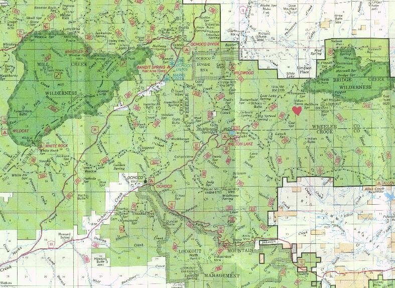
This map is pretty fuzzy, but it is the smallest of the Forest Service maps in terms of file size. Roads are clear enough, but road numbers are very hard to read. You should be able to use the simplified map at the bottom of this page to identify the relevant roads on the FS map. Map size is 50% of the size of the large map.
This map is the same scale as the above map but is more readable. Road numbers are fairly clear on this map. This map can be printed on a single page (use "landscape" page orientation) and remains fairly legible when printed. Map size is 50% of the size of the large map.
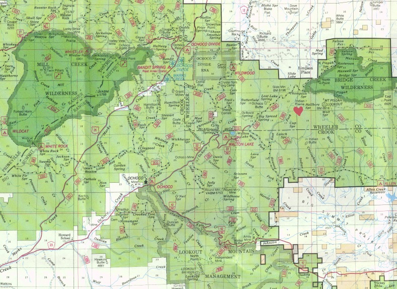
This map is somewhat larger and much easier to read than the above maps. It has also been rotated for easier printing. All of the important detail on this map can be printed to 3 pages of 8.5"x11" paper from your web browser (use "landscape" page orientation). This is probably the best map for printing if you want a clear, detailed map. Map size is 70% of the size of the large map.
This map is the clearest and shows the most detail of all of the maps. It is the base map used to create the other Forest Service maps on this page. This image will not print well from a browser. Both Netscape and Internet Explorer will cut off the right side of the map, which is where the site is located. This map is good for online viewing and can be saved to a file and printed from some graphics programs.
[Special Projects] [Good Things to Know] [Our Disclaimer] [Spring Council]
[Morphun] [How to Contact Us] [Thanksgiving Council] [Kids Stuff]
[Cyberlinks to Other Rainbow Information]
These pages are brought to you by Rainbow ' 97 Office crew